
The shelter, which faces south, is a small semi-circular cavity at the base of a cliff.
It is 12 metres long, extends back 7.5 metres at its deepest point and has a maximum height of 4.1 metres. The cliff rises five metres above the shelter's vault. A terrace, extended by an embankment, spreads out for several metres in front of the shelter. The terrace, which today stands only a few meters above the current level of the river, was at a higher level in Palaeolithic times.
Chrono-stratigraphy
Although the stratigraphic studies of Pierre David, Denise de Sonneville-Bordes, Jean-Marc Bouvier and André Debénath revealed a number of different archaeological layers, current research distinguishes two occupation phases for the site. The first was certainly during the Middle Magdalenian, and the second during either the Middle or Upper Magdalenian. Ongoing work on the archaeological material will definitely allow researchers to precisely date these chrono-cultural attributions.
Archaeological context
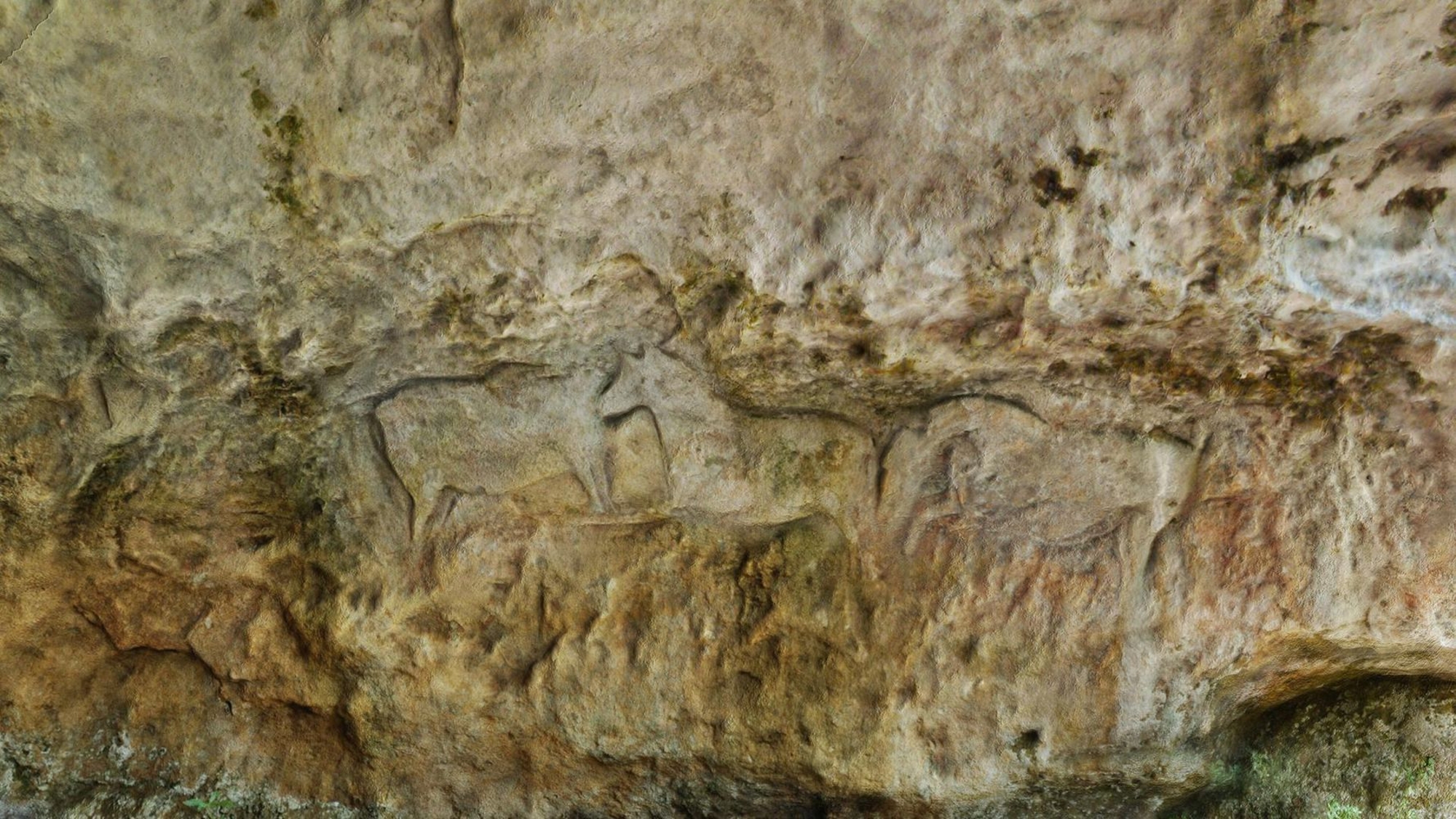
The site, whose shelter and embankment were the site of a large-scale occupation in the Palaeolithic period, was found to contain a wide range of archaeological material. Middle and Upper Magdalenian cultures can be ascertained by the presence of groups of material that are characteristic of this period (flint knapping, bone working, decorative objects). The wall art, which was partly covered over by the layer in which Upper Magdalenian occupation traces were found, can be dated to the initial occupations in the Middle Magdalenian period.


